947
One of the project's goals that I'm currently working on is to connect 947 municipalities in Catalonia. A municipality is a territory that has a single city hall, but it might have several urban cores.
For example, the municipality of Bellvís has two urban cores. The biggest one has 2042 inhabitants, and the second one has 153:
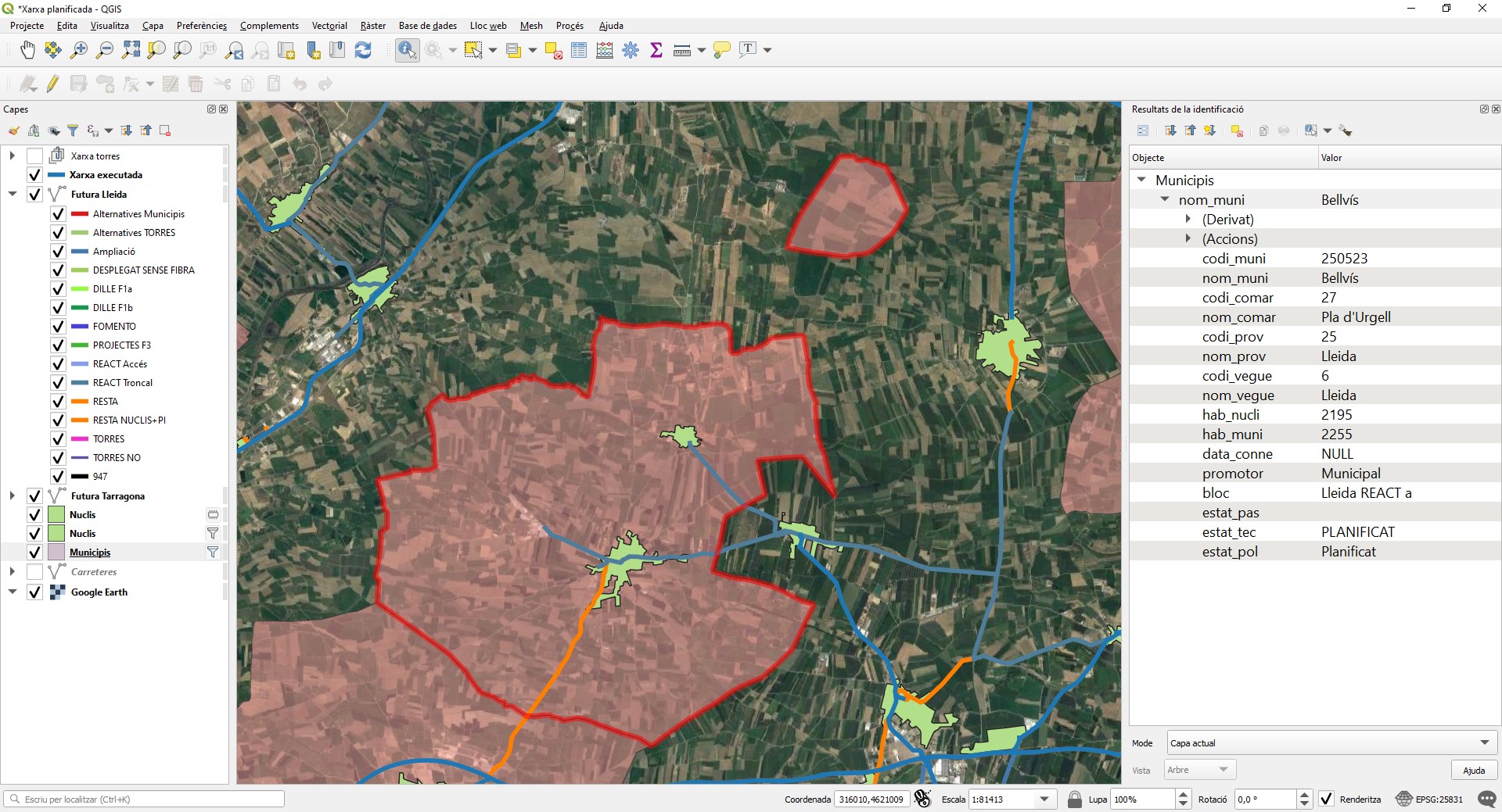
The government considers a municipality connected if one of its urban cores has optical fibre deployed. The engineering team always tries to arrive at the most populated one at first. However, technically, even if a small urban core of fewer than ten inhabitants is connected, we consider the municipality as a connected one.
When we decide a potential optical fibre route, the network passes through 3 phases:
- Network planned
- Network in progress
- Study of conditions
- Upcoming works
- In works
- Deployed
The network team is providing a public service. Hence, we need to know the status of the network at any given time with precision. The first step is to draw the planned network into a shapefile that contains several routes to connect the municipalities. This shapefile is our guidebook. We use it as a guide to know what is going to be constructed next, and what moneybag is going to pay for the works.
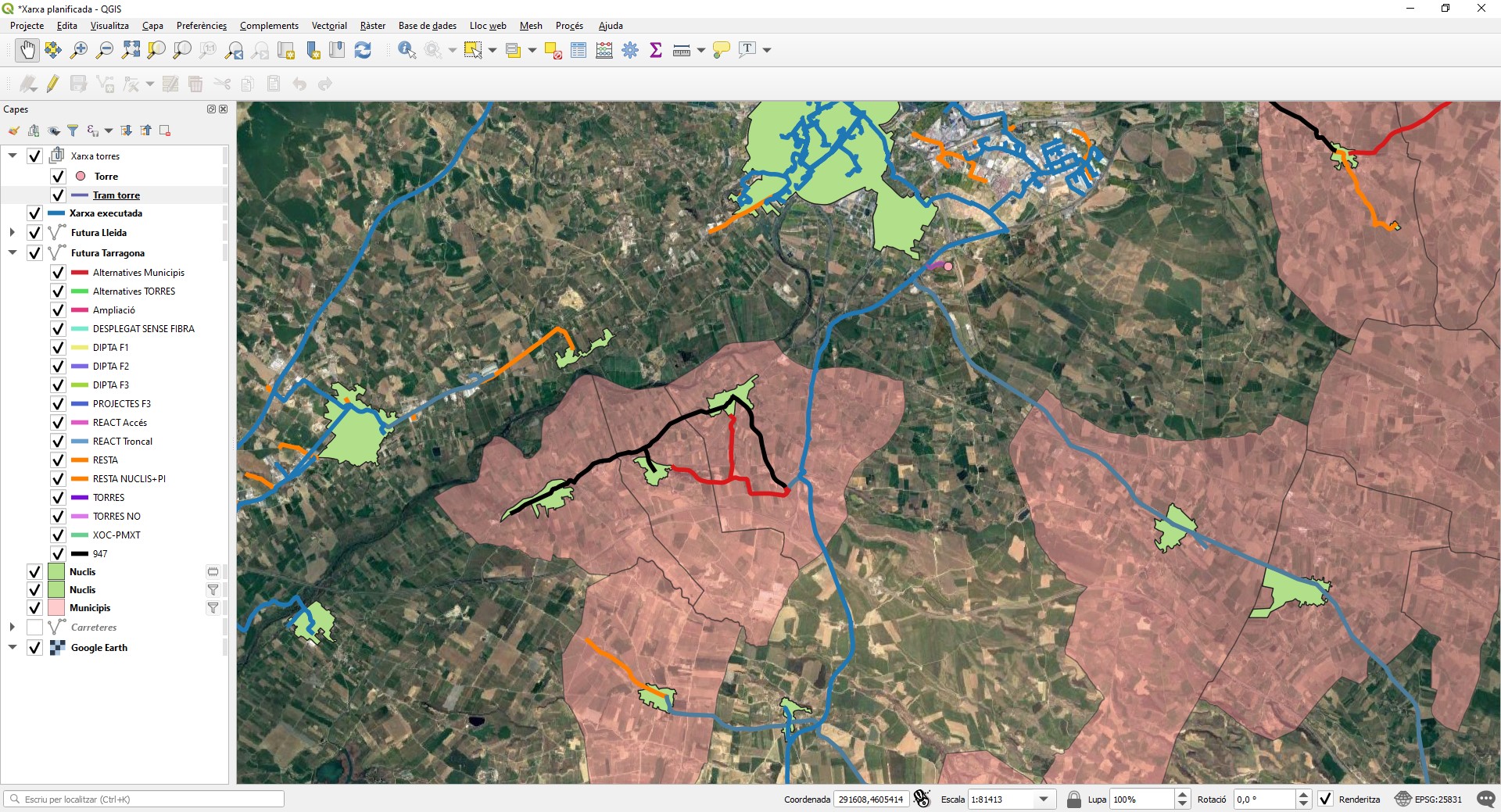
Sometimes, the planned route isn't feasible, and we need to find an alternative route to connect a municipality. From the picture:
- Blue: Deployed optic fibre
- Black: The one that we need to connect 947 municipalities
- Red: An alternative to the black one (if we aren't able to deploy it)
The idea over the last days is to identify the paths of those municipalities that aren't currently connected, so that we can contact the road holders to propose the construction of the canalisation to deploy the fibre.

Hi, I'm Erik, an engineer from Barcelona. If you like the post or have any comments, say hi.